Mt. Pulag: The Towering Queen of Luzon
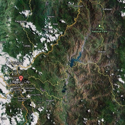
Destination: Mt. Pulag (Ambangeg Trail a.k.a. The Executive Trail)
Elevation: 2,922 meters above sea level (2nd highest in the country)
Location: Bokod, Benguet
Time to Summit: 5-6 hours (in 2 days)
How did we get there?
Last Minute Preparations
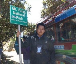
The PAMB Office (approx. 1.5 hrs.)
There is a bathroom there that you can use as an alternative to the bathroom available at the ranger station.
Be sure to make your last minute preparations at the ranger station. Below are my tips: 1. Save your strength, hire a porter! You will not only help the locals, but you can focus on enjoying the sights and sounds.
2. Light weight dri-fit clothes recommended. You will only need your jacket when it rains and when your at the campsite.
3. Bring water (1-2 liters) and some snacks for energy – biscuits, candies and trailfoods such as mixed nuts.
4. Apply sunblock – The air is thinner up there and you are closer to the sun
5. Sunglasses – same reason above
6. Bring a walking stick or a telescopic trekking pole
7. Waterproof the stuff you brought with you
8. Taking a five-minute break for every thirty-minute trek is a reasonable pace
9. STRETCHING! STRETCHING! STRETCHING!
Part 1: The Vegetable Road/Pine Forest (approx. 1 hr.)
 |
 |
 |
 |
 |
 |

Entering the next part of the trail
|
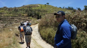
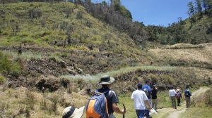
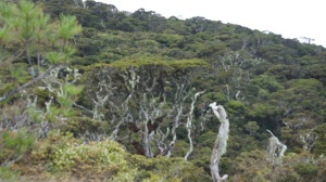
After the short, but steep ascend, the terrain gets kinder. From this point forward, the mountain trail offers a generous helping of ascends and descends. And the views of the flora, and if you’re lucky maybe fauna too, will astound any first-timer. As you go deeper into the forest, you will find yourself entering an ancient forest, and in some areas, you can’t help but think that it looks like the jungles of Pandora (Avatar film). Old trees and ferns abound, some of them looks alien or outlandish. Might be worth taking a picture of. The trail is in good condition. No need to do spiderman crawls or hanging-on-to-dear-life moves. No river crossings too, so you can wear shoes all through out the trek. Campsite 1 is approximately an hour deep in the mossy forest. There, you can take a rest at the hut and/or take a bathroom break at the… bathroom, so no need to step behind the bush and do no. 1 and 2 in Mt. Pulag. If you notice another steep ascend, then campsite 1 is waiting for you in the other end. there is a spring along the trail too. It is potable, but its not always available. Don’t underestimate this part of the climb. Its very exhausting and humid. The good thing though is that there are no bugs, snakes or any creatures you wouldn’t like to encounter.
Part 2: The Mossy Forest (approx. 3 hrs.)
 |
 |
 |
 |
 |
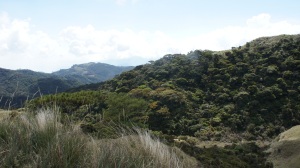
Entering grasslands
|
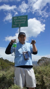
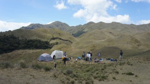
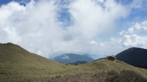
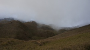
At campsite 2, we found ourselves resting below the infinite blue sky. Cloud cover was light and the sun is high. It was hot there, by the way, so sun protection is a must. While our guides were pitching the tents, our climbing team decided to wander around the rolling hills of the campsite. The sights were to die for! There are various hills there that you can climb. There is a cell site there too, so network coverage there is strong. At around 5:00 p.m., we noticed the weather getting cooler and the winds getting stronger. When we looked at the horizon, we saw a wall of fog approaching – a sign of bad weather. We found out later that the tropical depression in the Visayas region, became Typhoon Bebeng! But that didn’t bother us as we know that its still far away. The mountain ranges of the Cordilleras, by the way, can have various micro weather systems, so it can rain/drizzle in one part and sunny in the other… We got the former later in the evening! It was amazing how fast the weather changes up there.
Part 3: Grasslands/Campsite 2 (approx. 15 mins.)
 |
 |
 |
 |
 |
 |
 |
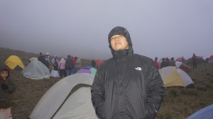 |
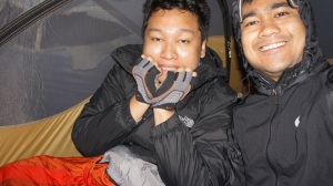
Earlier in the evening, the gust of the wind and the murmur of other climbers rocked us to sleep. It was deeper into the night that was very uncomfortable. The winds are getting stronger and stronger. Each time the wind blew, our tent rocked as if something is hitting it. But there was no rain, thank God. It was very cold, noisy and uncomfortable. It was a miracle we had any sleep at all. At around 1 a.m., we heard someone calling out our name from outside of the tent. Our guide, knowing that our tent damaged, offered his tent to us and ended up sharing a tent with our other guide. (Maybe he heard that we were complaining about the cold.) We immediately took the offer and made our way through the thick fog to our new tent, which was smaller but warmer.
Part 4: The Summit Assault (approx. 1.5 hrs.)
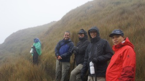
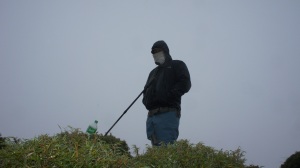
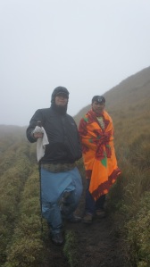
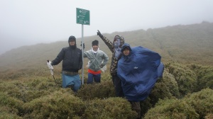
The trail to the summit is quite narrow in some parts and steep. The morning dew and drizzle made the trail muddy and slippery too. The assault was a combination of rolling hills, cliff-side trails and sheer mountain face. The trail was hard enough and it was made harder by the creeping chill brought about by the strong winds especially in the valleys. I really regret not bring gloves and a scarf with me. My hand was so pale and almost numb from the cold, but Elorde, our local mountain guide, stood by me and helped me keep the pace. But in spite of all the hardships, the view was very spectacular. The vast grassy rolling hills reminded me of Rohan (Lord of the Rings). At one point, I was so tired that I was moving on sheer willpower alone. All I thought about was to get one foot in front of the other and trudge on. It was a cold, long, seemingly never ending journey. An hour or so later, the summit was visible. The winds at the summit were violent. The thick fog covered the edges of the summit. One wrong step, and one can fall a tumbling death. The summit is quite small actually. I think it can only fit 25 – 30 people at one time. Up there, you can see bigger dwarf bamboo bushes, which the local guides cleverly used as a shield from the wind. The strength and the windchill of the the gusts up there are much worse, since there are no more terrain or foliage to block them. We took victory pictures at the summit. Our prize was a strong sense of accomplishment and a freshly made warm cup of coffee, courtesy of our Team Leader.
 |
 |
 |
 |
 |
 |
 |
 |
Part 5: The Descend (approx. 3.5 hrs.)
Summit to Campsite 2 (approx. 1 hr.)
The rain began to pour harder as we made our way across the grasslands and into the mossy forest. The trail was wet, muddy and slippery, but it wasn’t so hard to trek through it downhill. We also encountered “traffic” along the way from ascending porters and other descending groups. (Be courteous to everyone you encounter on the trail. Greet them with a warm smile for courtesy.) After a while, the rain waned into a drizzle. Two hours later (with a couple of rest stops), we are back at the ranger station. There, we cooked our tuna pesto lunch at the house beside the ranger station. You can take a bath at the ranger station, but please be warned – THE WATER IS FREEZING COLD. At around 1:30 p.m., we boarded the monster jeep back to Baguio City.
Campsite 2 to the Ranger Station (approx. 2.5 hrs.)
Ranger Station to Baguio City (approx. 4.5 hrs.)
To be honest, the ride down the mountain was the worst part of the trip. You literally have to hang-on to dear life as the rough road and steep descend will throw passengers and bags around. I suggest you sit at the inner part of the monster jeep beside the bags so that you can lie down and save the trouble of holding on. But don’t sleep. You might find yourself with a lump on your head or a bloody nose when you wake-up. But it will over as soon as you hit the paved mountain side roads around near Ambuklao Lake. We arrived at the Victory Liner terminal in Baguio City at around 6:30 p.m.
THE EXPERIENCE I was the slowest in the group. Good thing our sweeper (the guide who keeps the pace of the group from behind) and the local guide was patient with me. They told me that this is not a race and I should climb at my own pace. So I did. While the rest of the group was taking a 5/30 min. break, I took a 2/15 min. break instead. That pacing worked for me as I would prefer to be slow than to hurt my self or collapse under pressure – This is a prudent measure, IMO. Like the PAMB superintended said, “Dapat realistic. Pag di kaya, relax muna. Di pwedeng go lang ng go. Its better to be relaxed than to get hurt.” (You should be realistic. If you find it hard, relax for a moment. Its not right to push beyond your limit always…) There were times when I hated the trip, especially when it was so cold that I wished the trip was over. But one can’t quit up there just like that. You have to keep moving or else you become a burden to the group. Though I complained to myself, I never complained to the group. I just sucked it up and kept moving. The best reward of the trip was the feeling of accomplishment. Sure the view was beautiful, the people were great and reaching the summit was awesome. But nothing compares to that temporary feeling of invulnerability knowing that you conquered the elements and especially yourself. Who would have thought that a 230 pounder like me can make it? After the trip, I felt nostalgic asap. I longed to feel that feeling again. The feeling of accomplishment and immersing in the spirit of challenge. So I decided to make mountaineering as my hobby. I will make it a point to climb 1 mountain every month starting with day hikes near Manila. I will also try to better my body so that later on, I can try more difficult climbs. I will also make it a point to get a Basic Mountaineering Course and eventually join a club. This blog will serve as my diary to fulfill that quest.
OUR ITINERARY
| Day 0 (Friday) | |
|---|---|
| 9:00 p.m. | Rendezvous at Victory Liner Pasay Terminal (We bought tickets in advance) |
| 9:30 p.m. | ETD. Board Baguio-bound Victory Liner bus |
| Day 1 (Saturday) | |
| 3:30 a.m. | ETA Victory Liner Baguio terminal |
| 5:00 a.m. | Board monster jeepney bound for Bokod (pre-arranged by guides) |
| 7:00 a.m. | Arrive at roadside eatery (Toilets/Outhouse available) |
| 9:00 a.m. | Arrive at PAMB Office. Registration and orientation. |
| 11:00 a.m. | Arrive at ranger station. Organize climp party. |
| 11:30 a.m. | Start trek |
| 1:00 p.m. | Arrive at campsite 1 (toilet available) |
| 3:30 p.m. | Arrive at the grasslands/campsite 2 |
| 4:00 p.m. | Rest or explore the grasslands while guides set-up camp |
| 6:00 p.m. | Dinner and socials |
| 9:00 p.m. | Lights-out |
| Day 2 (Sunday) | |
| 4:30 a.m. | Wake-up/Stretch/Suit-up/Breakfast |
| 5:00 a.m. | Start summit assualt |
| 6:30 a.m. | Reach summit (No sunrise due to bad weather) |
| 7:00 a.m. | Start descend to campsite 2 |
| 8:30 a.m. | Arrive at campsite 2. Rest and decamp. |
| 9:30 a.m. | Start descend to ranger station |
| 12:00 a.m. | Arrive at ranger station. Clean-up and eat lunch. |
| 1:30 p.m. | Board monster jeep back to Baguio City |
| 6:00 p.m. | Arrive at Victory Liner Baguio terminal |
| 8:30 p.m. | Board Manila-bound Victory Liner bus (we were chance passengers since all the evening schedules we fully booked) |
BUDGET


